After touring the Manitoba Legislature Building it was time to head to St. Andrews airport to meet with Air Cadets and plan our flight onward to Thunder Bay, Ontario.
We had been staying in a hotel in downtown Winnipeg so it was a long taxi ride from the hotel to St. Andrews Airport, which is quite a distance north-east of the city. The aircraft had been parked on a grassy/gravelly area and it had rained overnight so when we pulled the aircraft out of the parking area the tires were covered with some mud and gravel. The young man looking after fuelling the aircraft kindly washed the tires so that they would be clean for retracting after takeoff and not cause any problems with the landing gear mechanism.
The flying school at St. Andrews, Harv’s Air, is training 16 Air Cadets for their Private Pilot Licence this summer and they are expect to be licenced by mid-August. I met with the group at noon for a casual briefing regarding our Canada 150 Flight across the country and their flight training, the same training I had for my pilot licence as an Air Cadet 50 years ago. They had some interesting questions so it was nice to see such enthusiasm in a keen group of future pilots. We then headed outside for a photo of the group of Air Cadets in front of the Arrow with the Canada Flag.

The weather system had moved eastward, in our direction of flight, so the conditions ahead of us included a significant area of Marginal VFR weather. Going IFR was not a viable option to head into such a system. I filed VFR to Thunder Bay.
Winnipeg is on the eastern edge of the prairies and about 15 to 20 minutes after departure the terrain transitioned from prairie to lake country. I was able to capture a screenshot of my iPad with ForeFlight showing our aircraft position on the map as we crossed the border between Indian Bay, Manitoba and Shoal Lake, Ontario.

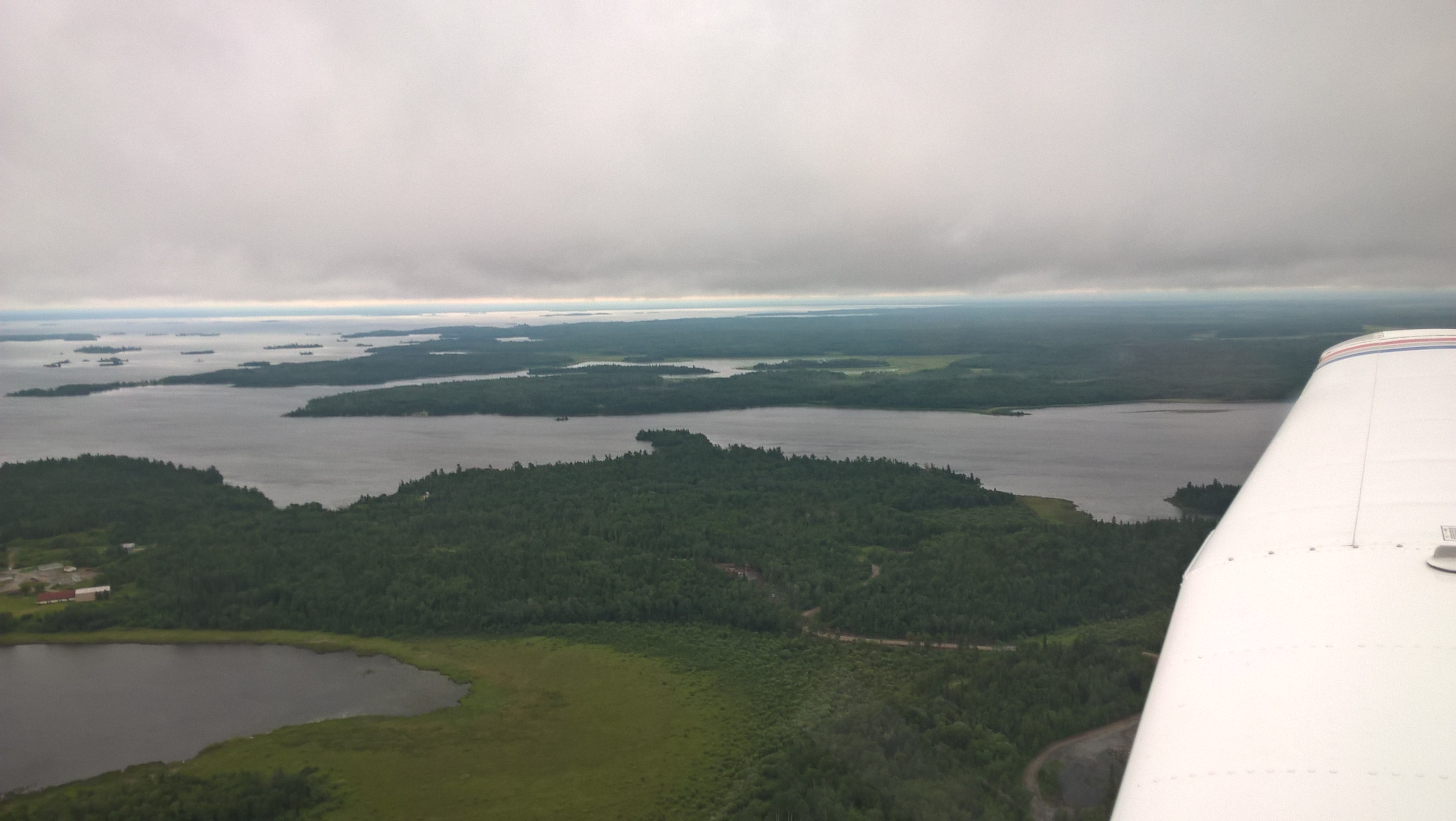
I also took a couple of photos out the window as we crossed the Manitoba / Ontario border looking left to the north and right to the south, showing the terrain and weather conditions that we encountered.

Crossing the Manitoba / Ontario border looking north and south.
The weather was rather poorly throughout the flight with Marginal VFR conditions all along our route. ForeFlight is a great tool to add situational awareness and help pilots stay safe. About forty miles or so after crossing the border into Ontario we were about five nautical miles south-west of the Sioux Narrows VOR. There were several towers nearby so I had ForeFlight set with the “Flight Plan – Profile” view selected and the “Obstacles” feature activated.
This screenshot of ForeFlight shows our Arrow on the map and a tower depicted just in front of the left wing. The upper portion of the screenshot provides data indicating that our cruise altitude was 1,873 feet giving us a clearance above the tower of 373 feet.

This photo was taken seconds later as we passed by the tower.

An hour and a half later or so, along with some tactical navigation, we were on the ground in Thunder Bay. There was a hotel real close to the airport and with all the poor weather and challenging flying it was time to call it a day.